by dvmosomy | Friday, December 20, 2024 |
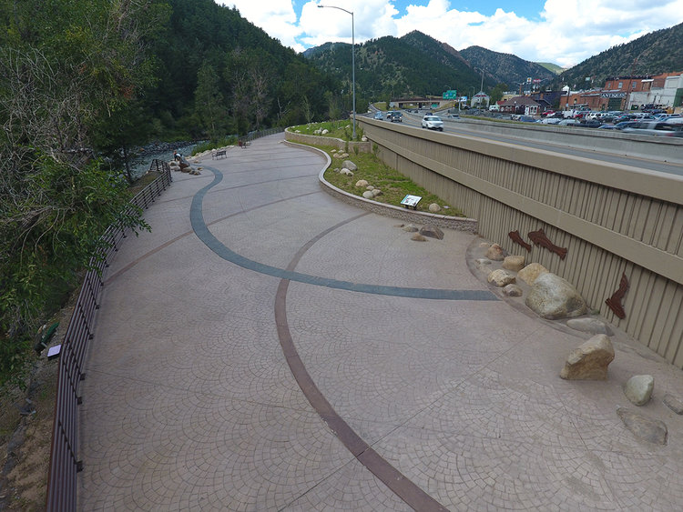
Waterwheel Park is an important point of interest along the Clear Creek Greenway trail and serves as an interpretive location for the Charlie Taylor Water Wheel, an iconic structure in Idaho Springs. The project has also developed educational features that discuss the significance of Native Americans in the area and the adjacent Brown Trout habitat in Clear Creek.
The redesign and reconstruction of Water Wheel Park is being done in conjunction with a larger regional project, Peak Period Shoulder Lane. These park improvements will mitigate the impacts to the park as a result of the road widening. The park improvements include constructing river access to Clear Creek, an enlarged park space, native plantings, and aesthetic features relating back to the history of the site.
Water Wheel Park was completed in July 2016.
by dvmosomy | Friday, December 20, 2024 |
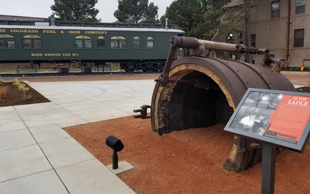
THK was retained by the Bessemer Historical Society to develop a conceptual plan for the placement of several Steel Mill artifacts west of, and adjacent to, I-25 on the north side of the former CF&I Dispensary building. THK developed a conceptual plan that focused on creating visibility of the large artifacts on display to travelers on I-25, improving visibility and circulation to the main museum door entrance, and incorporating circulation to and around the existing Mine Rescue Car. The concept also focused on pedestrian spaces, interpretive opportunities, xeric landscape practices and the display and reuse of historic elements.
Following the development and approval of the concept design, THK was again retained to complete construction documentation and cost estimating for the construction of the Steelworks Park. During the construction document phase, THK worked closely with the Historical Society Board of Directors and Staff as well as the Colorado Department of Transportation (CDOT). This project was required to undertake a CDOT review because funding for the park construction was obtained through an Intergovernmental Agreement. To date, all required clearances have been obtained.
THK and the Historical Society also worked closely with the City of Pueblo to meet City development objectives. The Construction documents and specifications were completed on time and on budget. THK developed all bid documents and has assisted the Bessemer Historical Society in Bid Administration and CDOT coordination. The project was completed in fall of 2017.
by dvmosomy | Friday, December 20, 2024 |
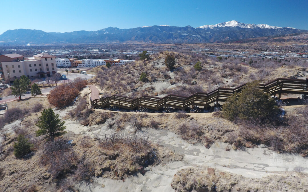
The Sherpa Trail was once a prominent pedestrian corridor on the University of Colorado – Colorado Springs (UCCS) Campus. The trail linked student housing with the main campus by traversing a hillside on the north end of the campus. Frequent storm events, steep trail grades and underlying bedrock compounded to cause progressive erosion of the existing crusher fines trail until it was deemed unsafe for student travel and closed by campus staff in 2015.
THK was contracted by UCCS to redesign approximately 400 linear feet of the Sherpa Trail to improve drainage, reduce erosion and design a resilient trail with a low environmental impact. The Sherpa Trail alignment has an average 15% slope and exposed bedrock on the hillside that contributes to increased destructive runoff during storm events. In order to ensure long term sustainability, it was essential to separate the natural drainage patterns in this area with the new trail surface.
THK used U.S. Forest Service standards and details to design an elevated boardwalk system that steps up the hillside for nearly 26 vertical feet and maintains a minimum six-inch separation from the bottom of the boardwalk to the top of the exposed bedrock, allowing natural drainage patterns and environmental function to remain, while providing a safe route for pedestrian travel along the steep grade. Interpretive signage was installed in four locations along the route to educate visitors about the unique environmental conditions of this area and new campus recreational programing aims to increase trail usage and further connect students with the environment on the UCCS campus.
by dvmosomy | Friday, December 20, 2024 |
The Silver Plume Mountain Park Master Plan was developed in 2023 by THK Associates, Inc. after the Town of Silver Plume purchased =/- 200 acres from the Jack Pine Mining Claim lands. These lands, in addition to other lands already held by the Town account for the 265 acre Silver Plume Mountain Park. The lands will be protected in perpetuity with a conservation easement held by the Colorado Historical Foundation.
The purpose of this Master Plan was to provide a guiding document for the preservation and management of the area which includes structures and artifacts from approximately 100 years of mining history in the area. The Park captures one of the most well-preserved cultural landscapes in the region.
The Master Plan looks closely at the existing conditions of the site. Several regionally important operations such as mining and quarrying were conducted the Park boundaries and many of the sites have completed inventory forms per the National Registry requirements. As a part of this project, ERO Resources completed and additional four inventory forms of cultural resources within the project.
The Master Plan developed goals and values of the property, and then provides detailed information for additional development and conservation of the site including security of the artifacts and oversight and stewardship plans for the Park. Finally, implementation plans were developed to include project partners, time frames and conceptual budgets for improvements and available funding sources.
The Master Plan will be used as a guiding document for the Town of Silver Plume Mountain Park Commission as well as the Colorado Historical Foundation to maintain the historical integrity of the site, provide additional recreational and interpretive opportunities, and monitor and document the site in the future.
by dvmosomy | Friday, December 20, 2024 |
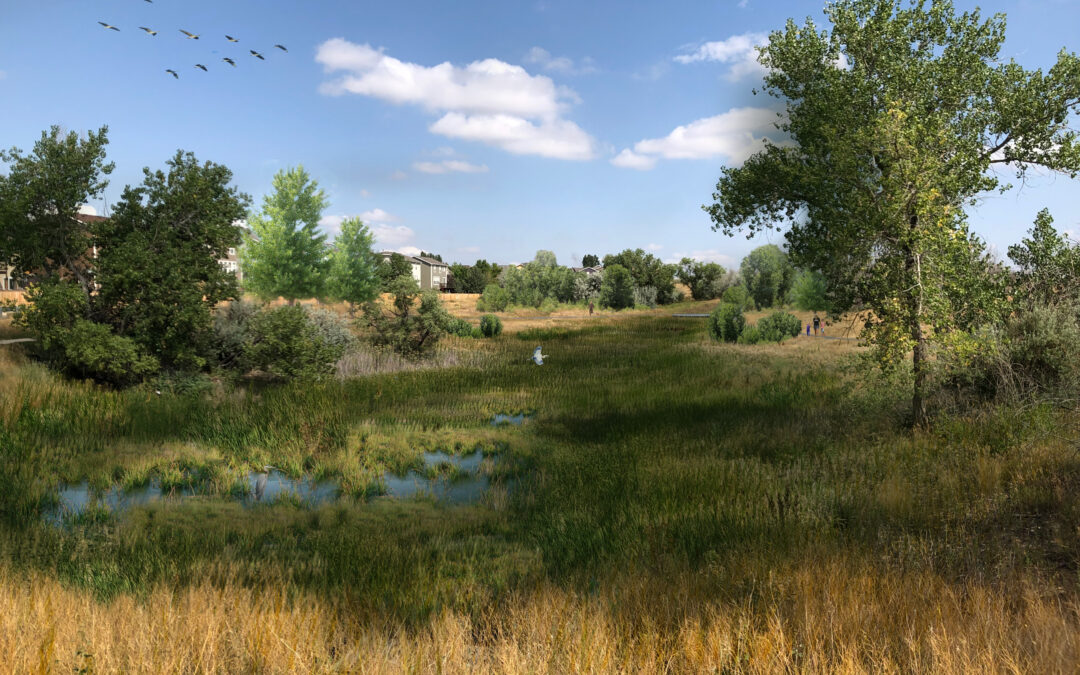
Purchased by the city of Thornton in 2003, Aylor Open Lands is an approximately 140-acre undeveloped property located at 136th Ave and Quebec St. The property was owned by the Aylor family since the early 1930’s. The Aylors used the land for a variety of farming purposes over the years, providing the open space with a rich background in agriculture. When the City purchased the property from William Aylor, the water rights and lease agreements were all transferred into the City’s name. With its unique site features and history, the City understood the opportunities the site possessed for natural resource preservation and public use and enjoyment.
To realize the full potential of the property, the city of Thornton partnered with Anythink Libraries in a shared venture to develop a new library/education center that could provide City residents additional education and recreation programming while preserving the natural open space. The City hired THK Associates, a local planning and landscape architecture firm with a background in balancing preservation and recreation, as a consultant to develop a Master Plan for Aylor Open Lands. Together the Design Team developed a vision and goals that would drive the development of the Master Plan.
Given Aylor Open Land’s proximity to a handful of privately owned parcels in unincorporated Adams County and two adjacent Thornton residential neighborhoods, the city of Thornton wanted to ensure that public engagement in the project started early and continued throughout the Master Plan process. The City also wanted to make sure that all of Thornton’s residents and surrounding community had an opportunity to be involved in the project since there was the possibility of a new education center.
The Master Plan provides the structure for Aylor Open Lands to become a regional and local destination for the City of Thornton and its community members to enjoy. While the recommendations provide the City a guide to develop the site, the partnership with Anythink Libraries provides the opportunity for robust educational and recreational programming that can be managed effectively and provide a unique experience for visitors of Aylor Open Lands.