by dvmosomy | Saturday, October 16, 2021 |
The Big Thompson Master Plan encompasses a 9-mile section of the Big Thompson River through the City of Loveland. This stretch of riverfront is an amazing resource for the citizens of Loveland, with broad undeveloped floodplains, trails, parks and open space. The 2013 flood caused damages along the corridor from undersized crossings, out of bank flows and erosion, among other factors. While some portions of the river support healthy riparian vegetation and have habitat that would be suitable for aquatic organisms, other portions are more degraded due to disconnection of the river and floodplain, bank erosion and limitations on available water due to upstream diversions that dry out the river through Loveland.
THK assisted the City of Loveland to develop a long-term vision for the Big Thompson River Corridor and to develop plans for enhancements that can be implemented in a phased manner in the coming decades. A major objective of this effort was to increase the benefits that the river and corridor provide to the citizens of Loveland by providing additional open space and recreational opportunities and enhancing natural habitat for aquatic and terrestrial wildlife, all while improving the level of flood protection and resiliency.
Through this planning and engineering effort, the City intends to transform the corridor into a landmark for the City, a recreational destination, a haven for wildlife in the midst of an urban environment and a more resilient river corridor. Most importantly, the River Corridor Master Plan will build on recent flood recovery efforts to identify potential projects that will reduce the flood hazards along the Big Thompson River, and provide additional protection of the health, safety, and welfare of the community. Through this project, the ultimate vision for the Big Thompson River corridor through Loveland is a fully “Connected Corridor.” This Corridor includes a network of interconnected greenways, parks, open space and natural areas that provide the public with opportunities for recreation and interaction with the river and nature.
by dvmosomy | Sunday, November 17, 2019 |
THK established a revitalization concept vision for the reach of Fountain Creek between Colorado Springs and the confluence with the Arkansas River in Pueblo. The project area was approximately 46 miles and included a width of approximately ¼ mile on both sides, including at a minimum, the 100 year floodplain. The plan defines the elements that are included in a relatively stable reach of the Creek vs. an unstable reach of the Creek. The plan establishes a series of landscape restoration techniques, including habitat conservation, that are intended to be a toolbox of techniques for revitalizing Fountain Creek. The plan developed specific demonstration projects using these restoration techniques. These projects were intended to be early action projects, as well as case studies, that could be built or expanded on in the future.
Demonstration Projects that have been completed by THK include:
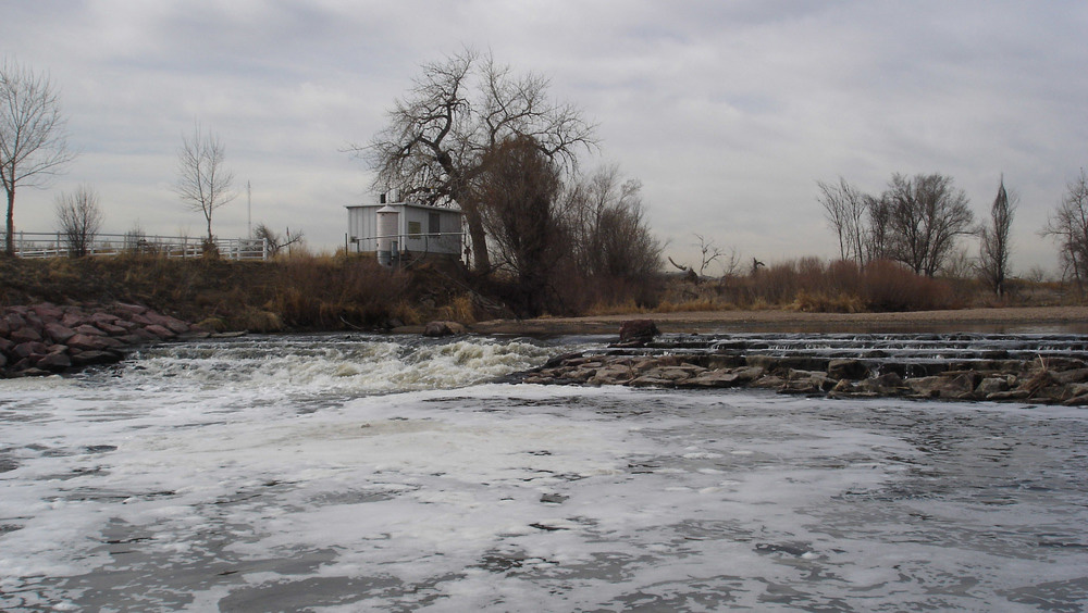
Fountain Creek Fish Passage – THK was retained to develop design alternatives for a fish passage for the Arkansas Darter and the Flathead Chub along Fountain Creek. THK developed design concepts for a naturalized structure that would allow the fish species to successfully navigate the diversion structure, reestablishing historical migration patterns.
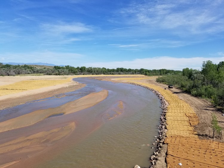
Fountain Creek Realignment at Clear Springs Ranch – Fountain Creek began to encroach on I-25 and CDOT Right-of-Way. THK developed grading for overflow/wetland ponds to provide flood volume and improve water quality as part of the creek realignment. THK supervised the installation of 100,000 willow cuttings and willow brush layering and 55,000 wetland plugs.
Fountain Creek Jurisdictional Wetlands – THK developed a 1.16 acre wetland demonstration project on Clear Springs Ranch. THK assisted with volunteer education during the installation of the project to ensure that the planting of wetland materials were placed and installed correctly by the volunteer planting crews. This project served as mitigation credit for a regional project.
Fountain Creek Restoration at Frost Ranch – THK was responsible for the restoration and revegetation of deeply eroded creek bank section along Fountain Creek. THK developed unique planting and bank stabilization alternatives that serve as a demonstration project for future restoration and revegetation projects. Soil fill was placed in Koir blankets. Native seed was applied to the top lift of the soil before the Koir wrap was applied. Brush layers of willows were placed between each soil loft. Willows were then staked into the soil lifts as well.
by dvmosomy | Tuesday, January 16, 2018 |
Fountain Creek’s lateral migration has created steep cut banks along this 1,600 linear foot project. The Creek has shifted into the adjacent Barr Farm property, causing the loss of agricultural lands and high sediment loads in the Creek. In addition, the Creek location is threatening overhead power lines and may eventually impact Overton Road.
The primary project goals were bank stabilization and erosion reduction. The project used rock and wood structures to protect the banks, did significant earth work to reshape the channel and elevation of the floodplain and significant revegetation efforts.
The construction of this $2.4 million project was completed in the summer of 2019. Currently, THK and the District are working on Phase II of the project, which is located directly north of Phase I.
by dvmosomy | Saturday, September 16, 2017 |
Fountain Creek is a sandy bottomed creek that experiences creek migration during floods. The Fountain Creek Watershed Flood Control and Greenway District has taken proactive measures to protect the new Pinon Bridge, constructed in 2004, after the original bridge was washed out in a 1999 flood. The movement of the Creek in recent high flow events has increased the risks to the new Pinon Bridge.
The project focused on realigning 1,200 lineal feet of creek to protect the bridge, enhance sediment transport and promote long term channel stability.
by dvmosomy | Wednesday, February 17, 2016 |
Following severe flooding in 2015, much of the floodplain and Creek area around the State Highway 47 Bridge sustained erosion and damage. CDOT conducted emergency repairs to the area to protect the SH 47 bridge structure. The nearly year-long project to restore 3,000 lineal feet of the Creek and protect the bridge stability was a $6 million dollar partnership between the FCWFCGD and CDOT. Project goals included realigning the channel to a more natural configuration, re-engaging the floodplain, protecting the SH 47 bridge structure and revegetation efforts. In addition, the project removed large amounts of debris along the banks including trash and vehicles.
The project used rock lined banks to re-establish a natural sinuosity of the creek channel. A guide bank and creek realignment were used to protect the bridge structure and significant revegetation efforts we utilized in the floodplain to provide long term stability, including protecting existing cottonwood galleries.
The construction of this project was completed in the spring of 2019.