by admin1 | Monday, March 31, 2025 |
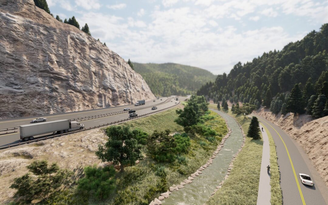
THK team members are currently working with CDOT to improve I-70 at the base of Floyd Hill in Clear Creek Canyon. The six miles of roadway reconstruction includes the complete realignment of I-70 and Highway 6 through the canyon. The realignment requires approximately 3 miles of new bridge structures, over 20 rock cuts, 3,000 linear feet of creek bank restoration. THK, Yeh and Chinook are all three responsible for the rock cut design and aesthetics. Yeh is specifically responsible for rock cut and slope stabilization design along with rock fall mitigation. THK is responsible for all forest and riverbank restoration, project aesthetics, recreation improvements, and CPW SB40 permits. Additionally, all three consultants were involved with helping to establish the new roadway alignments. THK and Yeh have worked for decades on mountain road development in Colorado. The experience and knowledge of this team will ensure that Park access roads are safe and aesthetically pleasing with rockfall mitigation. Additionally, ECO Resolutions planned and designed all the wildlife mitigation including roadway wildlife crossing structures.
by dvmosomy | Monday, September 16, 2024 |
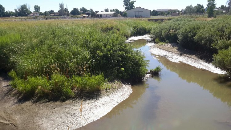
For this project, THK Associates developed a master plan for 6 miles of the Big Dry Creek corridor between I-25 and 160th Avenue. While the City of Thornton had already created ‘pearls’ of open spaces along the South Platte River and Niver Creek, Big Dry Creek was the last remaining ‘open space pearl’ needed to create a complete system of open space corridors in Thornton. Big Dry Creek provides outstanding opportunities for passive recreation and wildlife habitat and encompasses almost 300 acres of open space areas that have been preserved through acquisition by Thornton and Adams County.
The master plan assessed these publicly-owned parcels from hydraulic, geomorphic, environmental, social and recreational standpoints and created a framework for these areas to be connected both to each other and to the larger networks of trails, parks and open spaces. The key to creating an effective and implementable framework in the master plan was to understand that successful riparian corridors are complex systems that cannot be completely ‘controlled.’ By preserving and protecting a wide corridor that the Creek could move within without negatively impacting infrastructure (such as roads and buildings), we were also able to create a plentiful wildlife habitat alongside recreational amenities including a regional trail system and environmental learning opportunities.
Currently, THK is providing final design services for Phase 1 improvements including 2500 L.F. of creek restoration and a trailhead.
THK is also completing final design on 3 additional segments of trail that will be completed by Jan 2021.
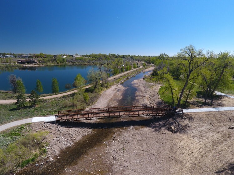
by dvmosomy | Saturday, September 16, 2023 |
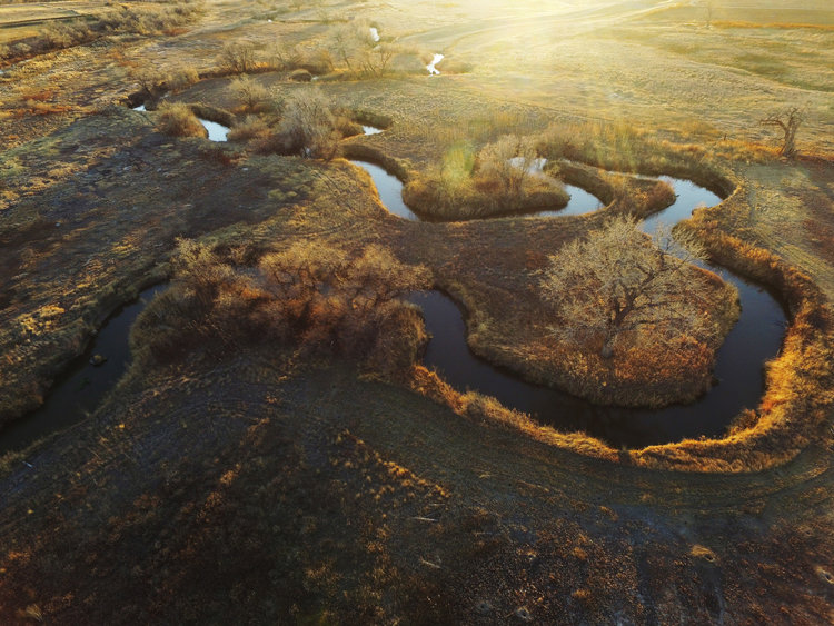
The Big Dry Creek Pilot Project was a priority project identified in the Big Dry Creek River Corridor Master Plan completed by THK. The City partnered with the Urban Drainage Flood Control District to bring contractors on board early to collaborate during the design process. The project is broken up into 2 phases, Floodplain Restoration and Passive Recreation. Set for construction in September 2019, the floodplain restoration plans were successful in achieving a no-rise certification. While preliminary stages showed a slight rise on site, THK expanded a natural drainage area to eliminate the rise in the floodplain while increasing biodiversity, promoting natural drainage, and creating a more enjoyable user experience. This project is also setting a precedent for environmental permitting through its data collection and monitoring.
THK is working with the City to complete the Passive Recreation Plans. The plans will include a portion of the Heritage Regional Trail, a connector trail, a new pedestrian bridge, a trailhead, secondary trails and opportunities for creek access.
by dvmosomy | Tuesday, September 13, 2022 |
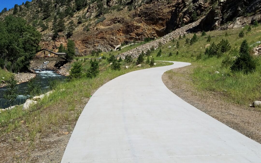
In 2012, THK, in combination with Clear Creek County and the Colorado Department of Transportation, began the planning and construction documentation for the Old Game Check Station Trailhead and 2,200 linear feet of improvements along Clear Creek. The trailhead focuses on multiple user groups, access to the trail system in Clear Creek County, access to Clear Creek, restoring native vegetation and habitat and protecting existing ecological systems.
The trailhead provides an important connection to the Scott Lancaster Memorial Path and bridge and will offer river access, restrooms and interpretative opportunities. The trailhead was designed to meet ADA accessible guidelines and features a paved parking lot, sidewalks and a plaza area. The plaza will highlight the Fallen Heroes Memorial, an installation remembering fallen military personnel.
The Creek restoration will return Clear Creek to a more natural state by reducing the channelization that has occurred on the corridor, reducing flow velocity, adding flood capacity, establishing and expanding native ecosystems and improving fisheries habitat. The Old Game Check Station Trailhead was completed in October, 2015 and was designed and constructed in association with the Twin Tunnels Widening Project.
by dvmosomy | Saturday, October 16, 2021 |
The Big Thompson Master Plan encompasses a 9-mile section of the Big Thompson River through the City of Loveland. This stretch of riverfront is an amazing resource for the citizens of Loveland, with broad undeveloped floodplains, trails, parks and open space. The 2013 flood caused damages along the corridor from undersized crossings, out of bank flows and erosion, among other factors. While some portions of the river support healthy riparian vegetation and have habitat that would be suitable for aquatic organisms, other portions are more degraded due to disconnection of the river and floodplain, bank erosion and limitations on available water due to upstream diversions that dry out the river through Loveland.
THK assisted the City of Loveland to develop a long-term vision for the Big Thompson River Corridor and to develop plans for enhancements that can be implemented in a phased manner in the coming decades. A major objective of this effort was to increase the benefits that the river and corridor provide to the citizens of Loveland by providing additional open space and recreational opportunities and enhancing natural habitat for aquatic and terrestrial wildlife, all while improving the level of flood protection and resiliency.
Through this planning and engineering effort, the City intends to transform the corridor into a landmark for the City, a recreational destination, a haven for wildlife in the midst of an urban environment and a more resilient river corridor. Most importantly, the River Corridor Master Plan will build on recent flood recovery efforts to identify potential projects that will reduce the flood hazards along the Big Thompson River, and provide additional protection of the health, safety, and welfare of the community. Through this project, the ultimate vision for the Big Thompson River corridor through Loveland is a fully “Connected Corridor.” This Corridor includes a network of interconnected greenways, parks, open space and natural areas that provide the public with opportunities for recreation and interaction with the river and nature.